
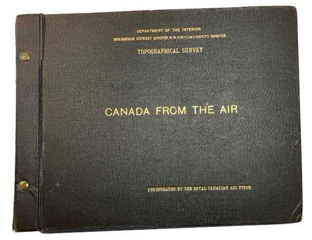
Canada from the Air: Photographed by the Royal Canadian Air Force
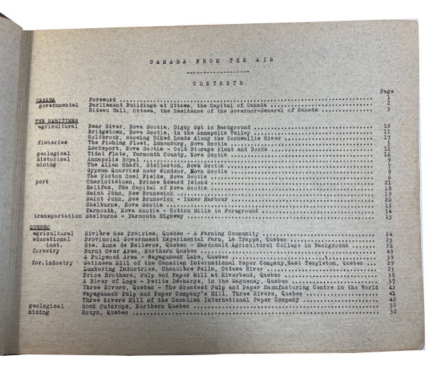
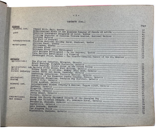
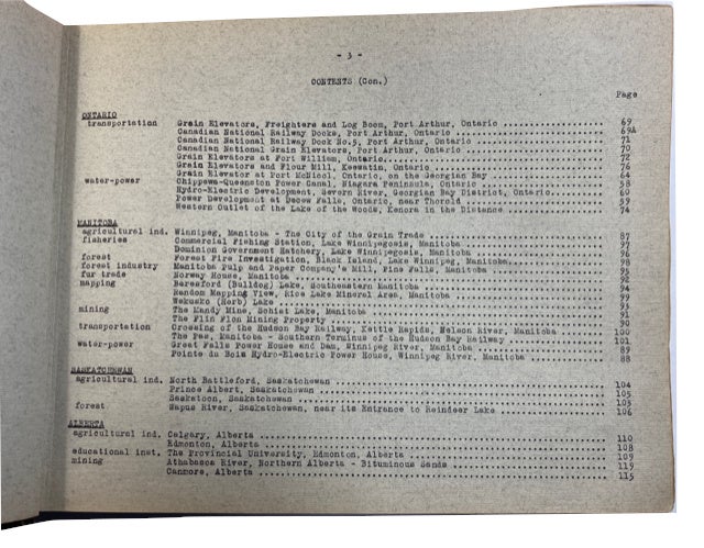
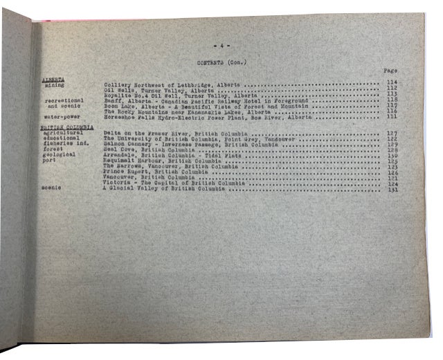
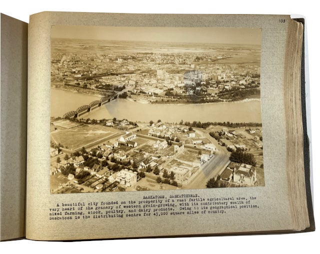
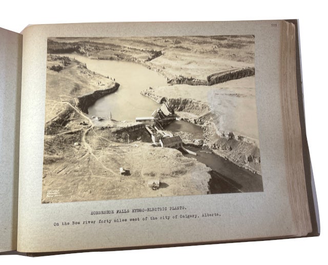
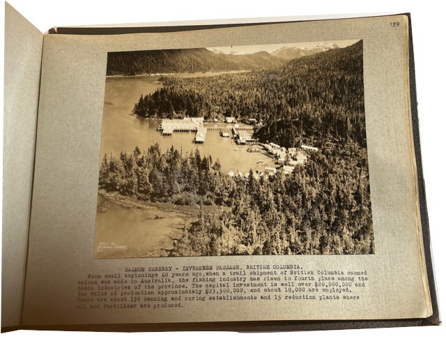
n.p. (Ottawa?): Canadian Department of the Interior. Topographical Survey, n.d. (presumably sometime between 1927 and 1930 since Charles Stewart is listed as Minister of the Interior). Hardcover. (1), 4, (1)p. followed by 131 mounted and captioned aerial photographs. The title-page, Contents leaves and Foreword are printed on one side of the first six grayalbum leaves followed by the mounted and captioned photos on one side of the remaining 131 (all so numbered) gray leaves. Oblong black cloth album (approximately 33 x 24 cm.). Front cover lettered in gilt. Some splitting on outer layer of cloth at bottom and top ends of the sides of the backstrip. Quality and detail of the photographs vary, at least partly because the photos were taken at altitudes as low as 200 feet and as high as 12,000 feet but also because some photos appear to have faded or lightened. The album is described in the Foreword as "... a selection of representative views of Canada. The album starts in the Maritime provinces of Nova Scotia and New Brunswick (plus one photo of PEI's Charlottetown) and works its way west across Canada's provinces to British Columbia. There are no photos from areas included in the modern province of Newfoundland and Labrador, or the modern territories of Nunavut, Northwest Territories and Yukon. According to the brief Foreword. The Royal Canadian Air Force took 161,000 aerial photographs covering 199,220 square miles during the initial five year period (1922-1927) which meant that only approximately 5 percent of Canada's total geographic area had been photographed by the end on 1927. We found no listing for this item in OCLC or elsewhere online. Very Good. Item #93174
Price: $3,000.00